


Board of Supervisors
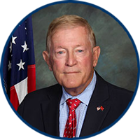
Col. Paul Cook (Ret.)
Vice Chairman/Supervisor
First District

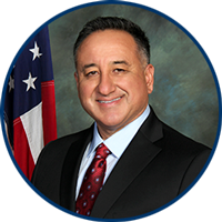
Jesse Armendarez
Supervisor
Second District
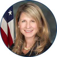
Dawn Rowe
Chair/Supervisor
Third District
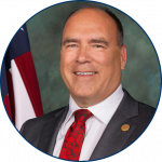
Curt Hagman
Supervisor
Fourth District
Joe Baca, Jr.
Supervisor
Fifth District

• Goals and Objectives
• County Budget
• County Code and Charter
• Redistricting
• Request Public Records
• Report Waste, Fraud & Abuse

• County Job Openings
• County Job Descriptions and Salaries
• Job Assistance
SB County Newsroom


Stay informed about SB County events
and news through our YouTube Playlist

Protect against COVID-19
Get Vaccinated

Countywide Calendar

Fri, April 26, 10:00 AM - 11:00 AM
Children's Network
Government Center

Sat, April 27, 11:00 AM - 1:00 PM
Museum
María Merced Williams and John Rains House


About the County
Covering 20,105 square miles, San Bernardino County is America’s largest county and a diverse public service organization governed by an elected Board of Supervisors and serving a community of nearly 2.2 million residents. San Bernardino County is comprised of more than 40 departments and agencies staffed by more than 25,000 public service professionals providing a wide range of vital services in areas that include public safety, health and human services, economic development, housing, recreation, and culture.
Our Job
Our job is to create a county in which those who reside and invest can prosper and achieve well-being.